
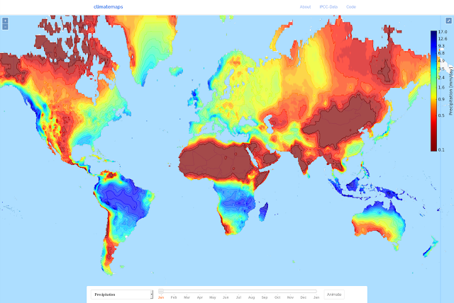
"Climatemaps visualizes the weather over the course of a year around the whole world. The map animates average global monthly climate data from 1961-1990 to show you when every location in the world has its hottest, driest or wettest weather." - http://googlemapsmania.blogspot.nl/2016/08/annual-weather-patterns.html#links